
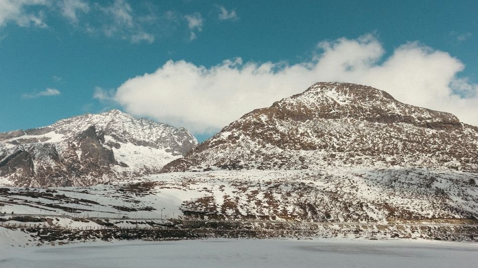
The mountains around Tawang have always looked beautiful from a distance. But hidden within those high-altitude ridges above the Mago area, seven glacial lakes sit quietly — and authorities say each one is a potential catastrophe waiting to happen.
Seven glacial lakes in the Mago area of Tawang district, Arunachal Pradesh, have been officially classified as high-risk, and disaster management teams are now scrambling to prepare the communities living in their shadow. The Arunachal Pradesh State Disaster Management Authority, along with the district’s DDMA and the State Disaster Response Force, has launched a full-scale awareness and training drive for villages downstream — places that would have almost no warning if any of these lakes were to breach suddenly.
The concern is not abstract. Glacial Lake Outburst Floods, or GLOFs, are exactly what the name suggests — a wall of water, ice, and debris tearing through valleys with terrifying speed. The Himalayas have seen it happen. Sikkim saw it happen. And the people living along the Tawang Chhu river valley know their terrain well enough to be worried.
The campaign kicked off at Mago village under Thingbu Circle, covering vulnerable settlements like Duri along with Indian Army personnel stationed in the area. Senior Consultant Dr Bhupen Mili walked residents through the science behind GLOFs — how they form, what causes a breach, and critically, how long floodwaters would actually take to reach Duri village and the Army camp. That last part — the flood travel time — is the kind of information that separates survival from tragedy.
Deputy Director of SDMA Dorjee Khandu revealed that six of the seven high-risk lakes share a single common downstream drainage system, meaning a breach in any one of them would funnel water through the same chain of villages, with Duri sitting dangerously close to the front of that line.
Khandu did not sugarcoat the situation. He pointed to recent devastating floods across the Himalayan region and told residents that in the most vulnerable spots, gradually relocating to safer ground may need to be seriously considered. That is a hard thing for any community rooted to its land to hear. But it reflects the honesty the moment demands.
“Natural disasters of such magnitude cannot always be prevented, but preparedness, effective early warning and timely evacuation can significantly reduce risks to lives and property,” he said.
The SDRF team led by Sangey Thinley followed up the awareness sessions with hands-on training — first aid, basic search and rescue, proper use of rescue equipment, and live mock drills so that none of this stays just theoretical. Tawang District Disaster Management Officer Gendan Tsomu urged villagers not just to absorb the training themselves but to bring the knowledge home to their families.
The programme has already covered Mago village, ITBP personnel, the Thingbu Hydel area, and the residents of New Maling and Tongsheng villages. It is set to expand to Phonda, Chaksam, Grenkhar and Dungshengmang. A separate awareness session was also held at Chagzam village under Kyidphel Circle, where local leader Tenzin Yendra Monpa urged people to stay calm, stay informed, and trust the official advisories when disaster does strike.
The glaciers are melting. The lakes are growing. And the villages downstream are running out of time to learn what to do when the water finally moves. The only real question is whether the preparations happening right now will be enough — and whether they will happen fast enough.