

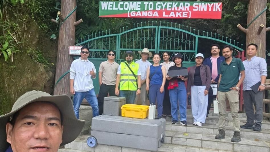
A serene lake tucked away in the hills of Papum Pare is now at the centre of a major scientific mission — and the findings could determine whether it survives the decade.
Locally called Gekar Sinying, Ganga Lake has long been more than just a scenic water body. For the communities around it, it is a living landmark. But now, scientists are raising the alarm. Researchers and engineers from the Centre for Earth Sciences and Himalayan Studies (CESHS) have launched a comprehensive scientific study of the lake amid growing concerns over its ecological future.
The study is being carried out under the guidance of experts and academicians from IITs and will examine the lake’s hydrology, geomorphology, morphometry and catchment dynamics. In simpler terms — they want to understand how the lake breathes, how it moves, and more importantly, how badly it is being hurt.
The threats are real and they are stacking up. Increasing human activity, disturbance in the catchment area, sedimentation and possible pollution are placing growing pressure on the lake’s ecological health, water quality and biodiversity. These are not distant, abstract worries. Anyone who has visited the area over the years would tell you the changes are visible — the waterline, the clarity, the life around it.
And there is a lot of life worth protecting. The lake supports regional biodiversity, including aquatic organisms, phytoplankton and documented butterfly species, some of which are of conservation significance. Lose the lake, and you lose more than water.
What makes this study stand out is the technology being deployed. Advanced unmanned aerial vehicle (UAV)-based photogrammetry and remote sensing techniques will be combined with field measurements, hydrochemical investigations and stable-isotope analysis to build a detailed picture of how the lake and its surrounding landscape are connected. Drones mapping a Himalayan lake — it sounds like the future, but the urgency is very much present-day.
Researchers will assess changes in water levels, lake volume, shoreline configuration, sedimentation patterns and watershed processes. The plan is to pull together morphometric, hydrological, chemical, isotopic, ecological and climatic data all at once — so the team can see not just what is happening, but why, and what comes next.
The study is also expected to establish baseline environmental conditions and assess how the lake is responding to both natural processes and human-induced changes. This baseline matters enormously. Without it, future scientists would have nothing solid to compare against, no way to measure loss.
According to CESHS, the findings could help provide scientific inputs for local governance, climate-risk assessment, freshwater-resource management and biodiversity conservation. That last part — freshwater management — deserves more attention than it usually gets. Northeast India sits on some of the region’s most critical water systems, and understanding one lake can unlock lessons for dozens of others.
Ganga Lake is described as a potential indicator of changes in local environmental and climatic conditions — essentially, a natural warning system. If the lake is struggling, the broader landscape likely is too.
A lake that has quietly existed for centuries is now being studied with satellites, drones and isotope labs. That alone tells you everything about the moment we are in. The science is beginning. Whether the action follows it in time — that part is still being written.