The monsoon has hit where it hurts most — right at the edge of India’s frontier.
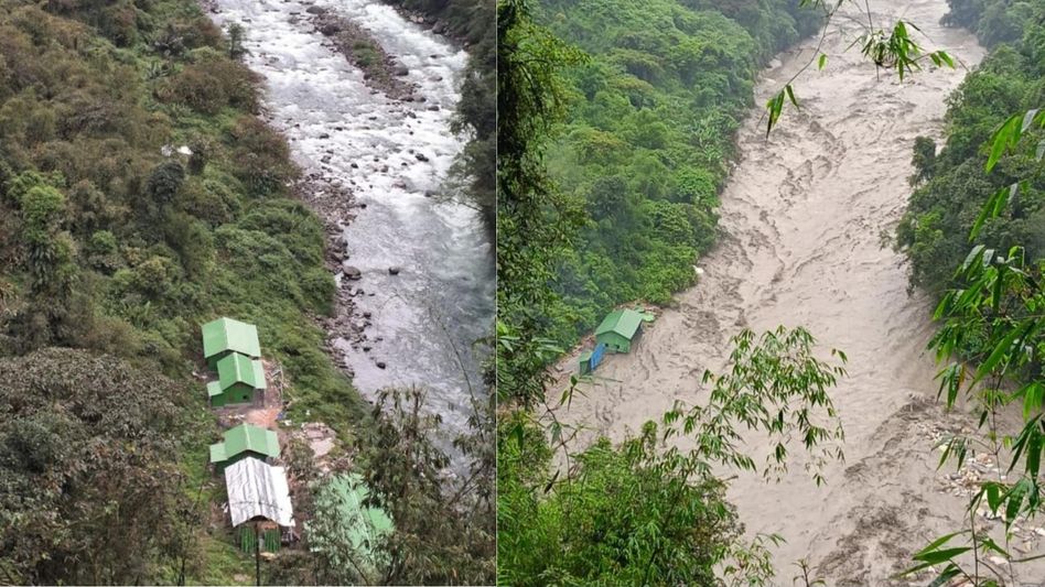
An Army porter camp near Darmu Pass in Arunachal Pradesh’s Kurung Kumey district has been completely washed away by flash floods, sending alarm signals from one of the most sensitive stretches of the India-China border. The camp, located at Tapa near Darmu Pass in Polosang Circle, was swept away as relentless rainfall turned the terrain into a death trap. Before-and-after images from the site leave little to the imagination — what was once a functional camp is simply gone.
A Strategic Zone Left Exposed
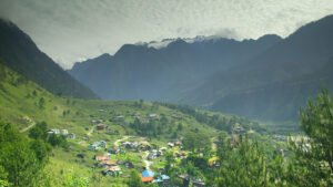
Darmu Pass isn’t just another mountain crossing. Situated beyond Milli village, this remote high-altitude pass sits in breathtaking Himalayan country — alpine lakes, snow-capped peaks, and terrain that has barely been touched by human development. But it also sits uncomfortably close to the Indo-Tibetan border, making it one of the most strategically significant spots in the entire Northeast. When something gets washed away here, it isn’t just a logistical problem. It’s a border security concern. And right now, the area is essentially cut off.
Parsi Parlo Goes Under
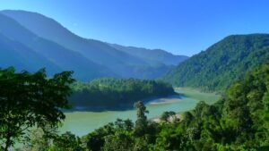
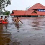
Meanwhile, just down in the valley, the situation in Parsi Parlo is nothing short of a disaster. The Kumey River, swollen well beyond the danger mark after days of non-stop rainfall, has submerged large parts of this key border town. The Inspection Bungalow is underwater. Government schools — underwater. Residential colonies — same story. It’s the kind of flooding that doesn’t just damage infrastructure, it rips apart daily life completely. Families left scrambling, officials issuing warnings over loudspeakers, and the river still rising. There’s something deeply unsettling about watching a town disappear under water that used to be a gentle river.
Roads Gone, Bridges Gone, Connectivity Gone
What makes this crisis particularly brutal is the isolation it creates. Multiple roads connecting villages in Kurung Kumey have vanished beneath floodwaters. Landslides and severe soil erosion have taken out valley bridges that communities depended on. Most critically, the road linking Parsi Parlo to the district headquarters at Koloriang has been severed — cutting off entire areas from administrative reach, medical help, and relief supplies. Getting rescue teams in? Not easy. Getting people out? Equally difficult.
Bigger Picture: Arunachal’s Monsoon Nightmare
This isn’t an isolated incident. The destruction in Kurung Kumey is part of a wider monsoon assault battering Arunachal Pradesh this season — roads destroyed, bridges collapsed, communities isolated across multiple districts. Local authorities have urged residents to stay away from floodwaters and remain on high alert. But when rivers are this angry and the land this unstable, advisories can only go so far.
When the floods recede and the damage is finally counted, the real question will be this — how prepared were we to protect our borders and our people in the one region where both demand equal attention?
HASHTAGS:-
#KurungKumey #ArunachalFloods #ArmyCamp #DarmuPass #IndiaChinaBorder #ParsiParlo #KumeyRiver #Monsoon2026 #FlashFloods #ArunachalPradesh #NortheastIndia #BorderSecurity #Landslides #FloodAlert #HimalayanFloods #NaturalDisaster #IndoTibetanBorder #FloodRelief #Koloriang #AbotaniTV